· · · Census Equally · · ·
Sense US Equally
Balancing Boxes
Quite some time ago a term paper I wrote received the favor of my Political Science Instructor. The simplicity of solution to the persistent gerrymandering nightmare was refreshing, but not necessarily plausible under the partisan corroded barn doors of the political spot light.
Since there is constant systematic gaming of the voting landscape in an ongoing effort towards the elimination of a country of-by-for We The People, I decided to revisit this topic of Congressional Apportionment.
There are already methods in place to accomplish redistricting, yet the only way to help ensure non partisan fairness is to work to make subdivisions of a state or territory randomly configured, with the aim of districts occupying areas as close to a square as possible. Such that each district has minimal length to width ratios.
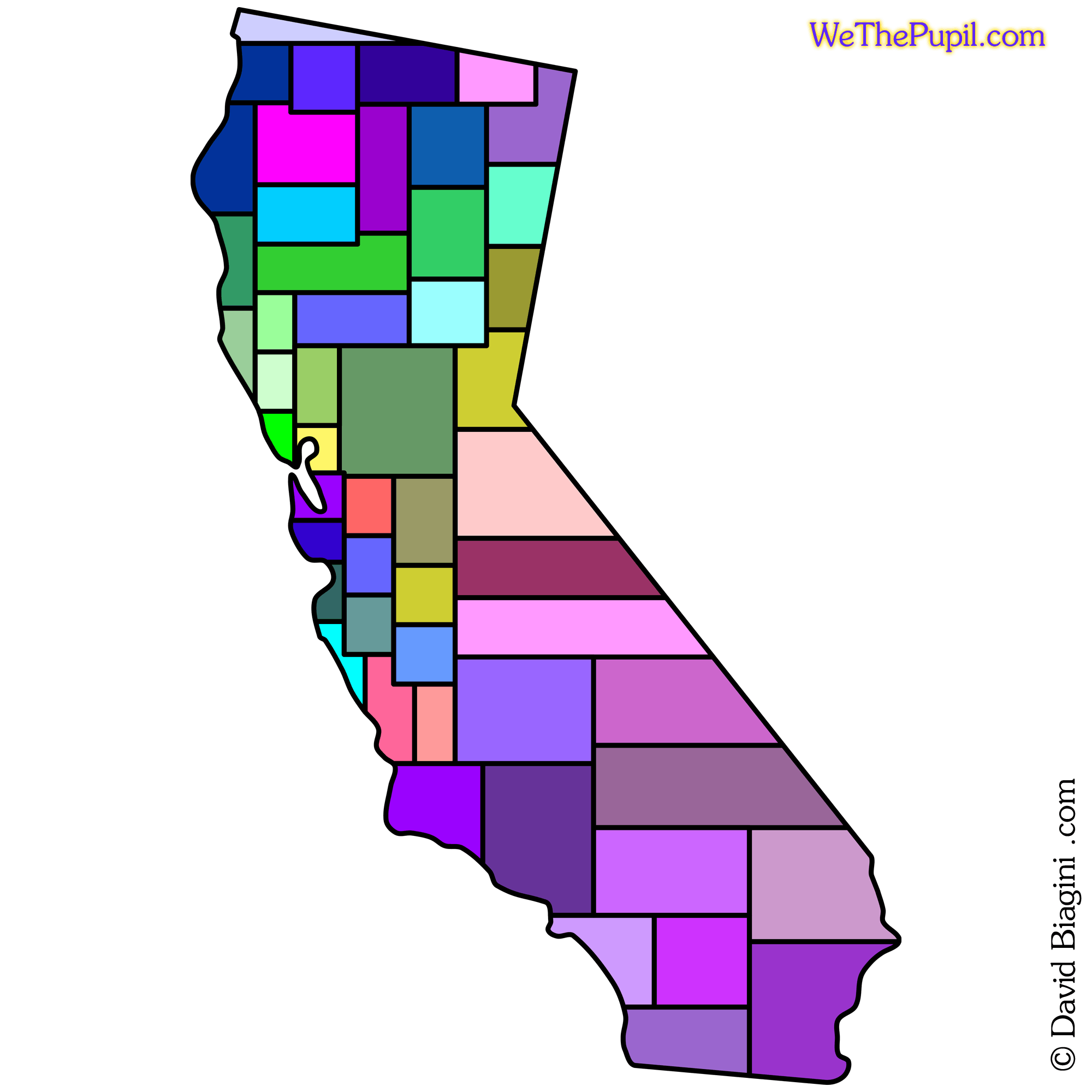
Another criteria would be to predominantly ignore physical landscape features. Although this may seem counter to adequate representation, it could prove to open up avenues of increased cooperation across district boundaries. A simple block approach would render something like the fifty two boxes in the following California graphic.
::
We The Pupil
Fractal Area Integrated Redistricting
FAIR
In my essay presentation during a Political Science course, the solution was to rework district mapping based on halving.
Basically it took the premiss of population tallies for any given territory or state and simply halved the portion of map into equal census members. Then each newly formed halve was halved. And so on and so forth until the cartographic form was filled to capacity with varied sized boxes of equal representation based simply upon number of people in the block.
Since revisiting the redistricting concept for this article, it soon became clear that the 'halving' approach will only work if the total allowed number of districts is a power of base two. Any district total that defaults to 2, 4, 8, 16, 32, 64, etc. will accommodate halving very comfortably. Any amount falling outside of this pattern above one will need to be adjusted for halving to be efficient, then adjusted back to original amount.
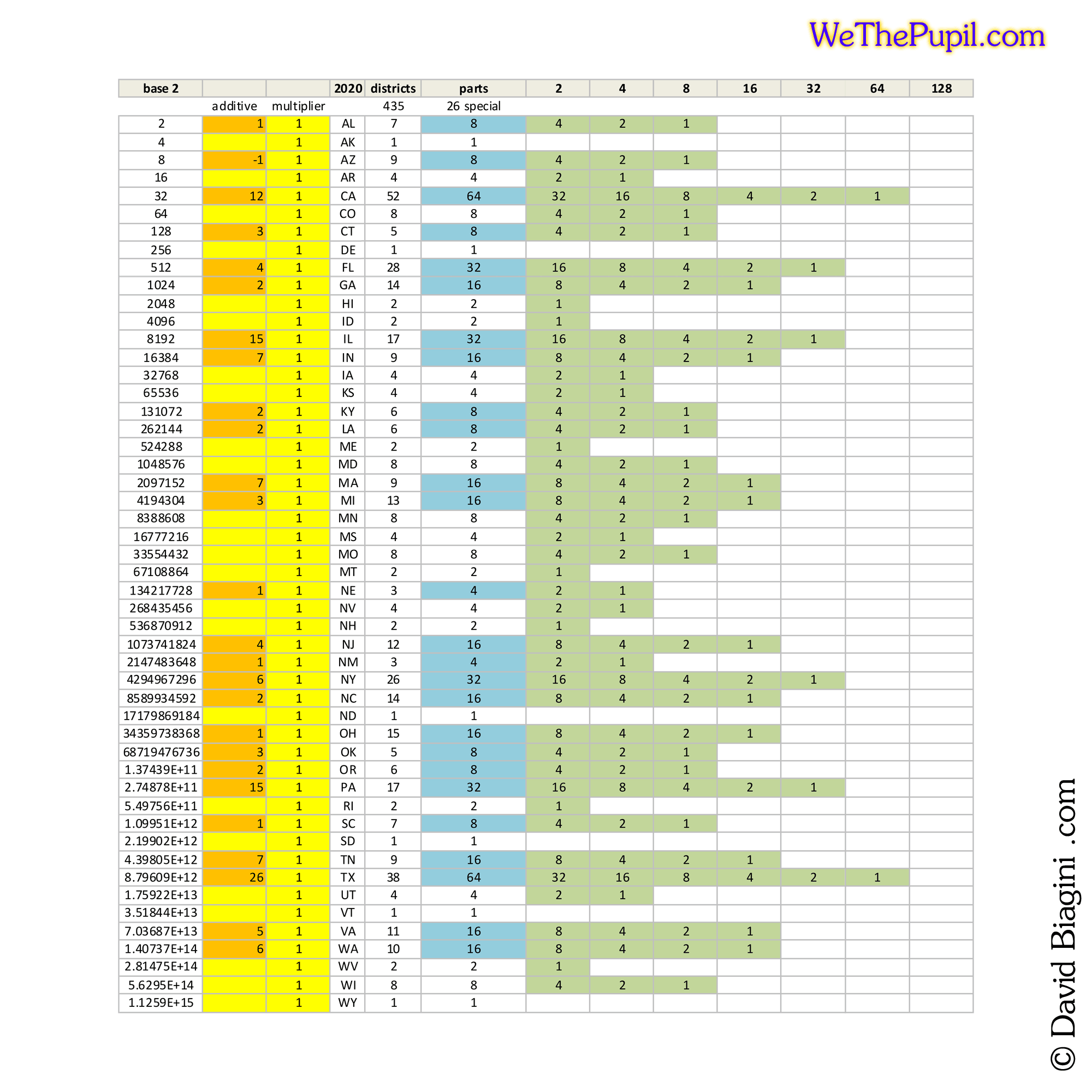
The base two approach is to work from the end result of district allocation and shift the amount either up or down. Shifting up will refine the detail associated with each newly drawn area. And shifting down would decrease detail resulting in an overall more simply bordered footprint.
The three following graphical studies showcase New Mexico and Arizona, since their districts do not conform to a base two breakdown. New Mexico will have three districts and Arizona will have nine.
::
Money Charms
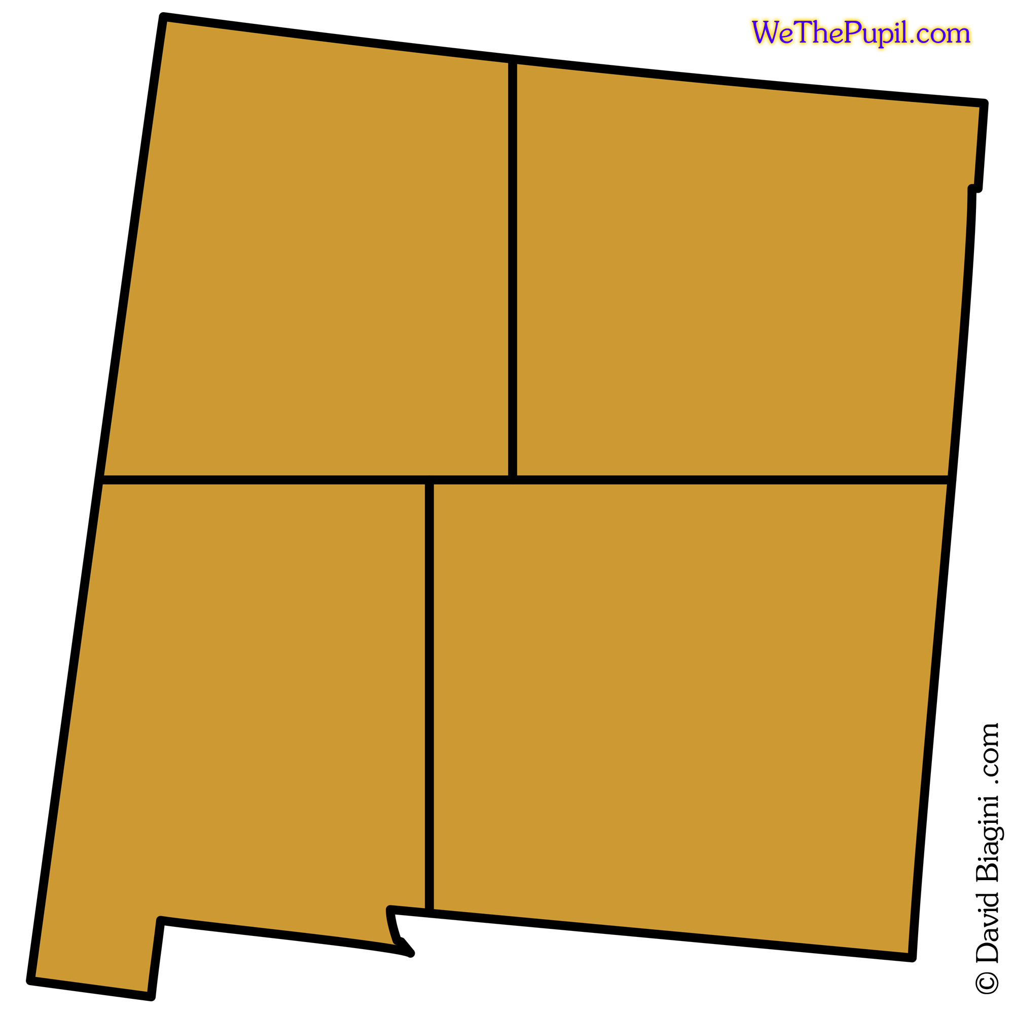
New Mexico
4-12-3
In the following series of New Mexico graphics, the amount was shifted up from three to four.
With four equal populated portions, the next step is to further subdivide each into the end goal of three parts of equal population. For a balanced fairness, a pie chart seems best, with the pole being situated either randomly, population centered, or guided human choice. In this example four multiplied by three will render twelve.
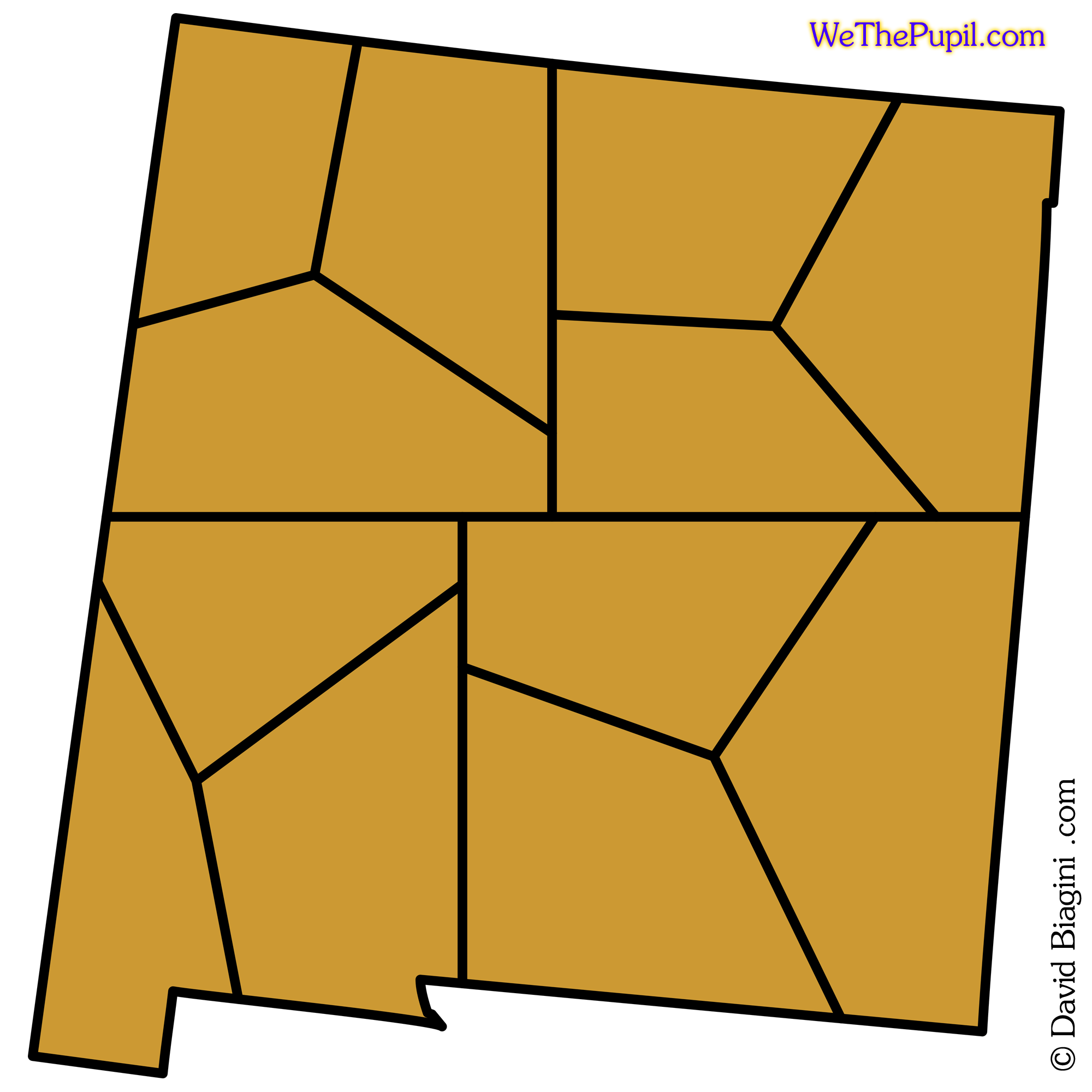
Next the objective is to connect the smaller regions in such a manner as to form a simplified and relatively square footprint consisting of the base two number utilized, in this case four.
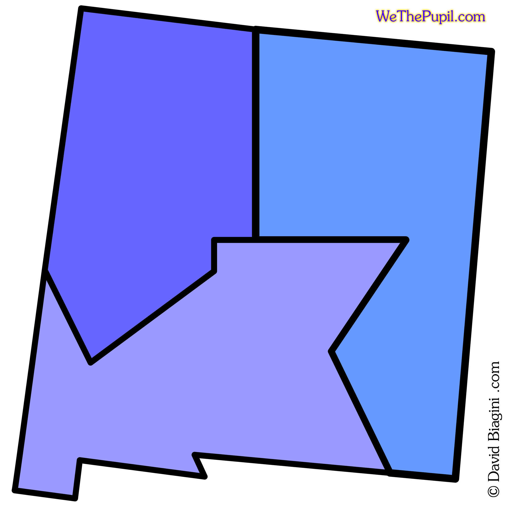
The goal of a simplified border is accomplished, yet as can be seen the areas are not square, but there is none of the 'worming' that occurs with the following of physical landscape formations or political gerrymandering.
::
Hello Hummingbirds
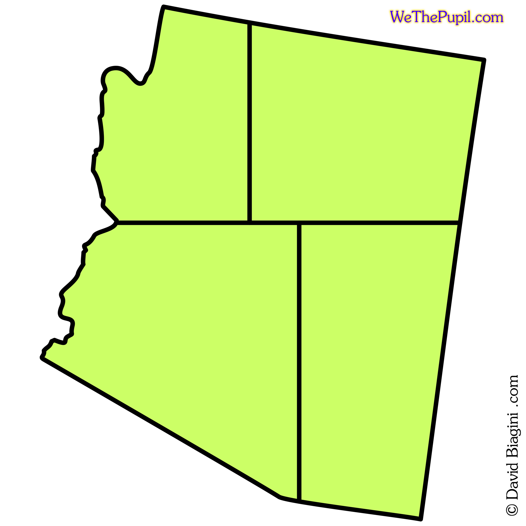
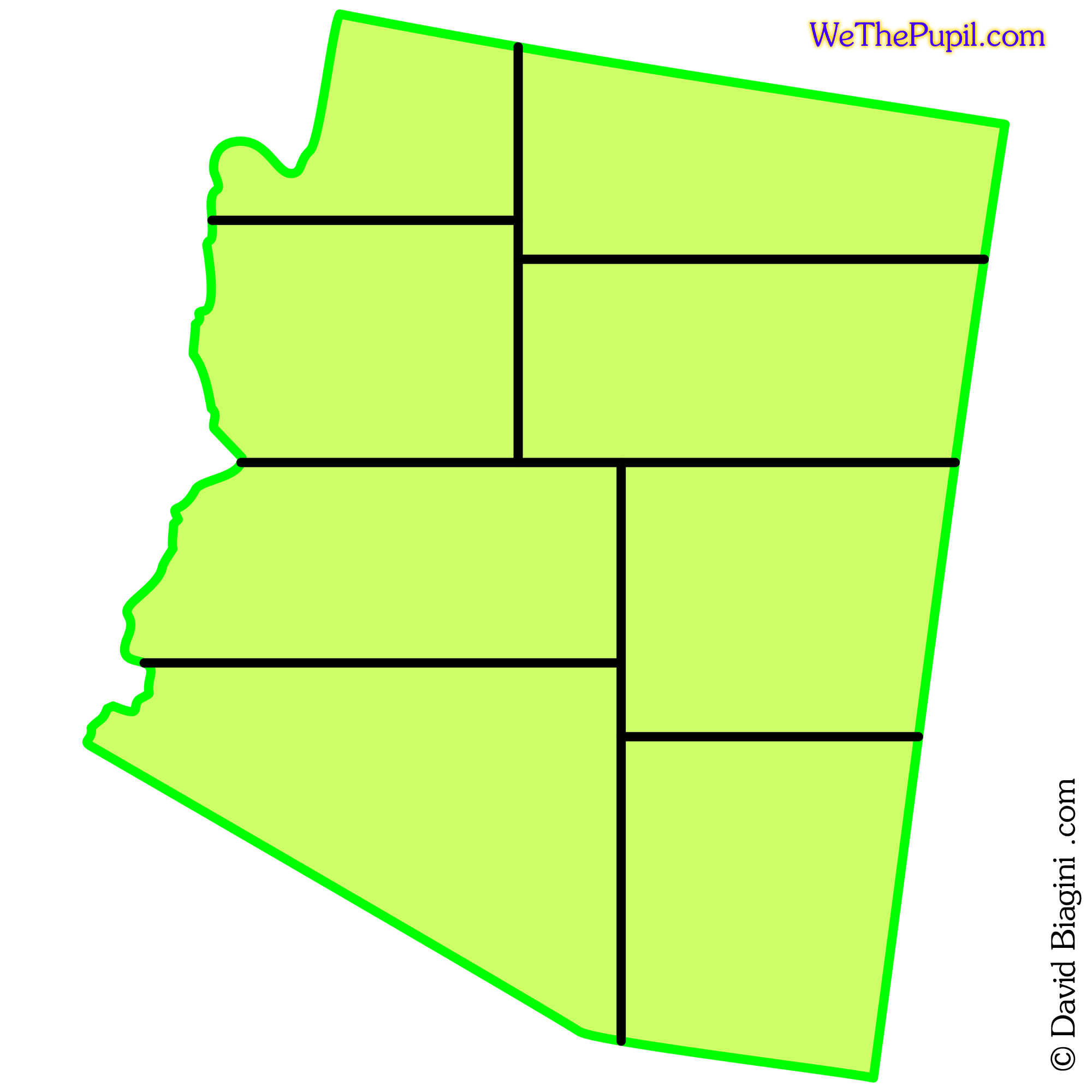
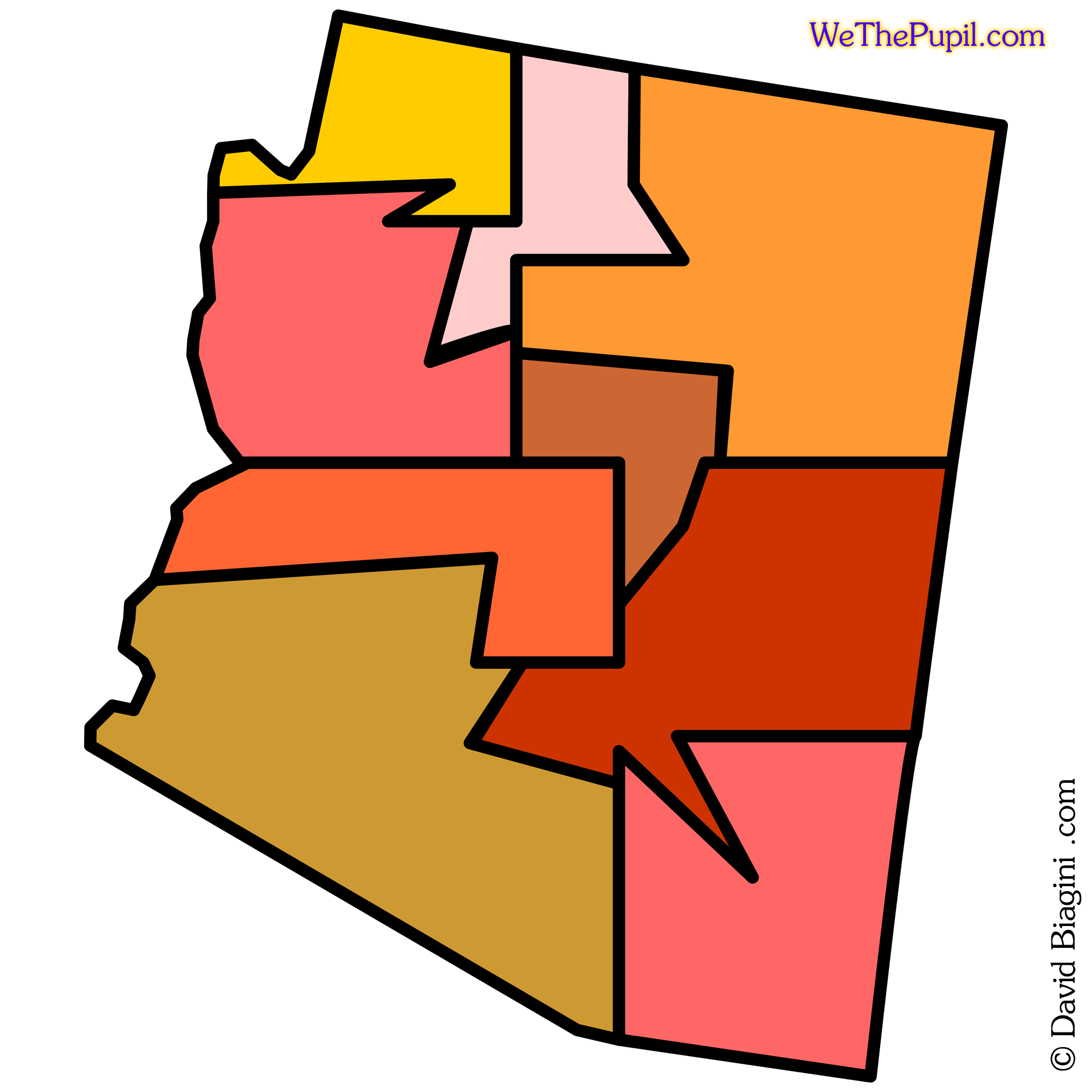
Arizona
4-36-9
In the following series of Arizona graphics, the amount was shifted down from nine to four.
The four equal populated portions are further divided each into the end goal of nine parts. Using the pie chart method reveals fours stars of nine wedges.
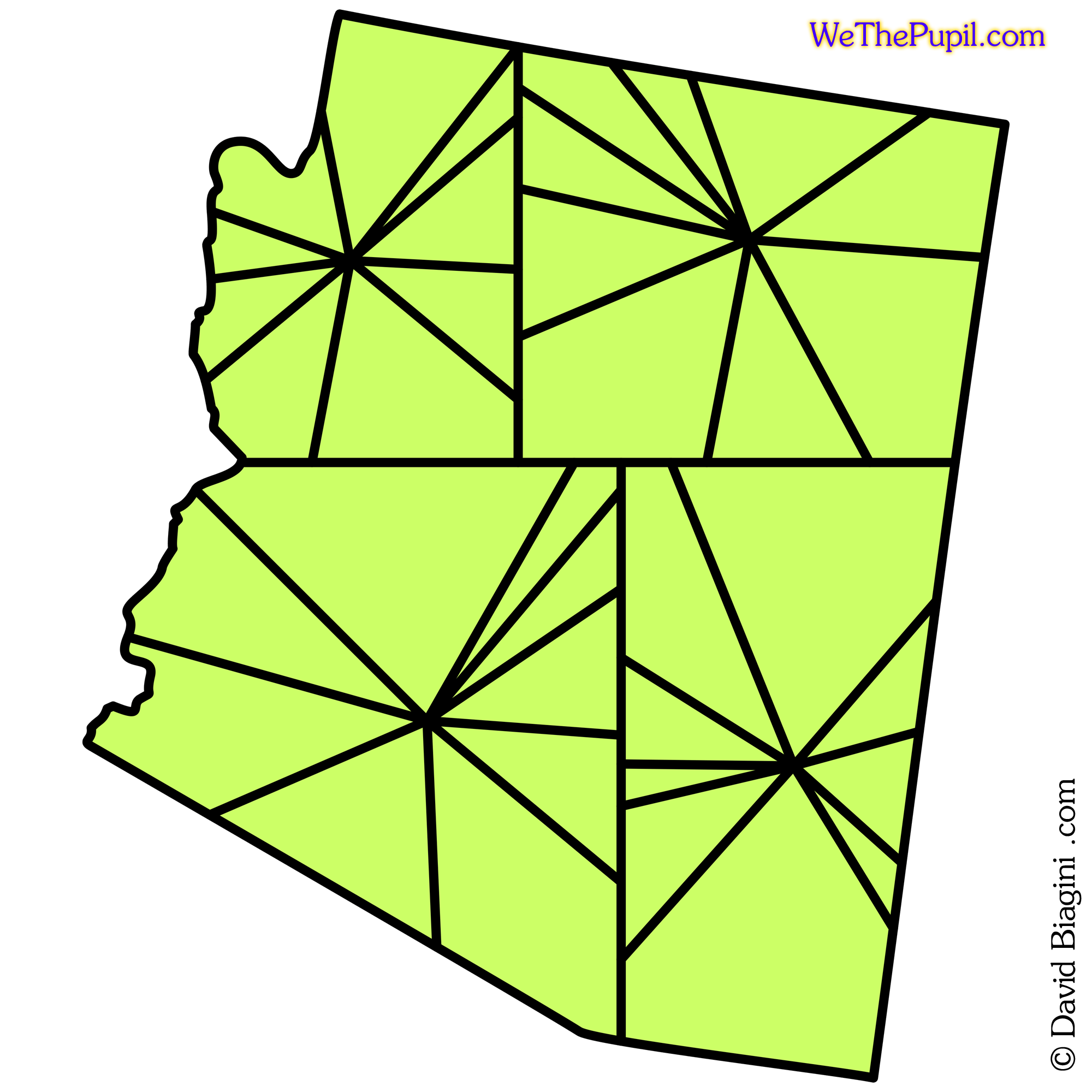
Combining four slices in as tightly grouped and connected as possible results in the following nine districts.
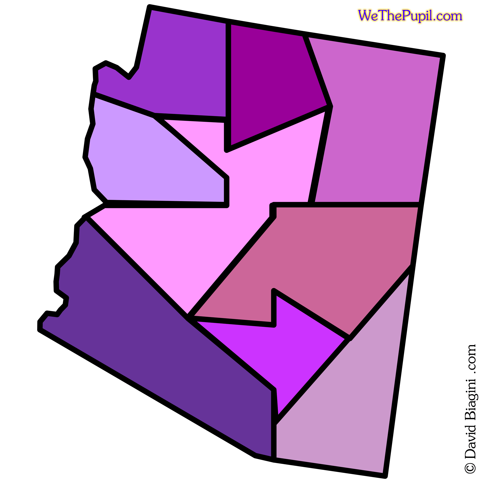
The goal of a simplified border is accomplished.
::
California Quarter Case File
Arizona
8-72-9
In the following series Arizona's end goal of nine districts is shifted down to eight.
Each eighth is then sliced into nine parts.
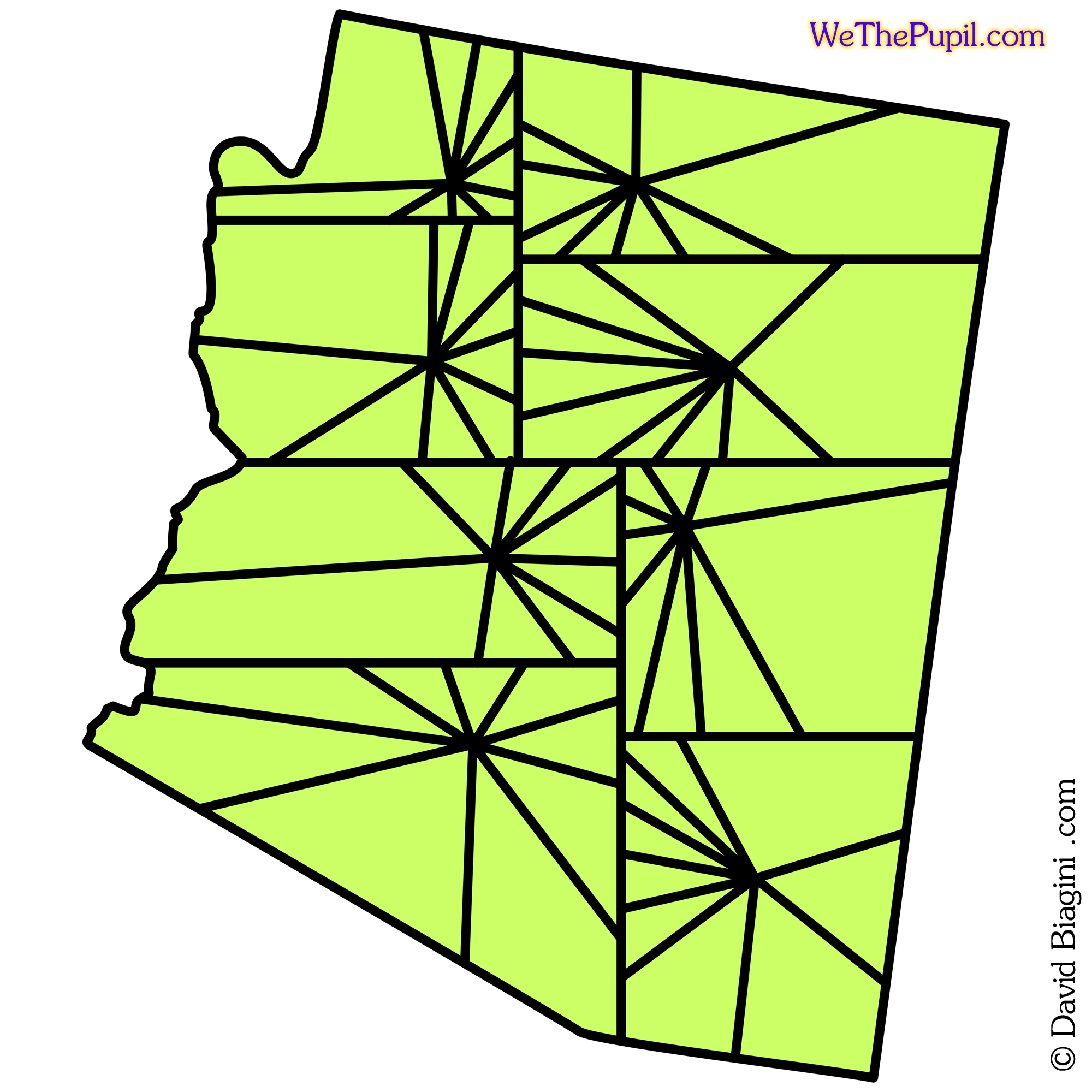
And finally groupings of eight slices are combined as closely as possible to a square footprint, to form the required nine districts.
Using a larger base two number resulted in a more detailed wedging which ultimately creates more intricate bordering.
Although this may not be the end all be all for redistributing Congressional Districts, it is a good avenue of study that could provide models of increased quality for accurately and fairly representing the population of Our United States of America.
::